|
Galleons
Weather Report: Weather Forecast for the North
Atlantic Ocean: Between the Equator and 10 degrees
N Latitude: Winds Calm Between 11 degrees N Latitude and
30 degrees N Latitude: Winds E at 25 knots. Between 31 degrees N Latitude and 40
degrees N Latitude:
Winds W at 2-3 knots. North of 41 degrees N Latitude: Winds SW at 18 knots |
Tuesday,
December 3, 2019 |
Code* |
Reading
You
will begin recording your final podcast tomorrow Always be sure to have a self-chosen book with you each day.
|
Runaway
to Freedom Chapters 11-12 Discussion today On-going assignment: Please load these pages into your PDF
Notes App and keep up with them daily as we continue reading Runaway
to Freedom Book Podcast scripts due Thursday. These links are provided for those
working on the witness parts for the Columbus trial. |
C Due
at end of book H H |
|
Written
Language |
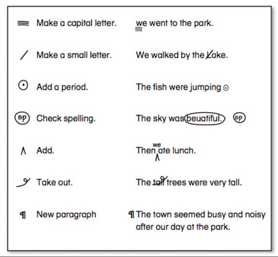
Editing sentences |
|
|
Social
Studies |
The
Algonquian People Read
about a Spanish Galleon recently found off the coast of Columbia |
C |
|
Resources for Daily Geography: Political Map of North America Political Map of South America |
|
|
|
Mathematics |
Lesson
3.8 Complete
p. 199 – 200 Enter
answers for p.199-200 here Freckle
- Money |
H |
|
Science |
Cloud
Journals and |
H C C |
|
*Codes |
C=completed
in class; H=finish as homework if not complete; D=didn’t get to – will hold
till later; P=have proof reading checked by parent and signed. |
|